In our Essence of England series, we speak to values-aligned creatives, entrepreneurs and familiar faces from across the South West about their lives, work and what ‘Englishness’ means to them.
David R Abram is a Welsh artist, now based on the border of Somerset and Wiltshire, not far from True Grace HQ. A writer by trade, David began experimenting with aerial photography to capture bird’s-eye view images of prehistoric ceremonial sites and settlements, rendering visible shapes and forms barely discernible from the ground.
Over time, David’s work has gathered a large following, shedding light on some of the country’s most spectacular ancient sites and forgotten histories. Now, he has channelled his passion and knowledge into a book, the ‘Aerial Atlas of Ancient Britain’, which features over 220 photographs of sites and settlements across the UK, along with engaging explanations of their archaeological context. David also leads archaeology walks in locations across the South West, illuminating points of connection to the ancestors who walked the lands thousands of years ago.
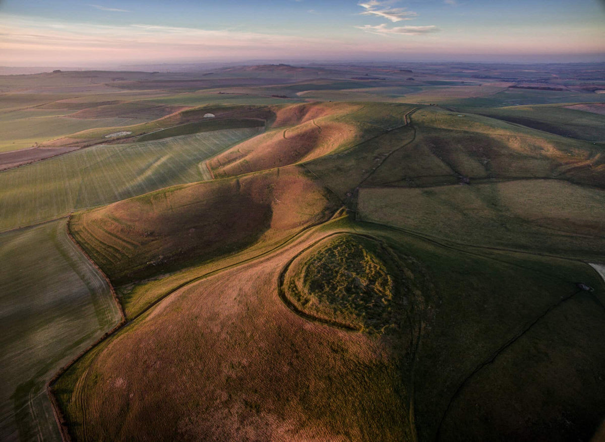
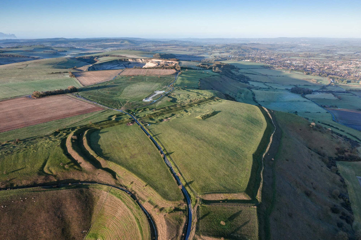
We spoke to David about what captures his imagination about these prehistoric sites and why ‘England’ itself is a relatively modern idea.
What first inspired you to photograph ancient sites?
I lived in various places around Wales as a child and then went to school in the Mendips in Somerset so there were always prehistoric monuments on the horizon and I used to walk to them. I was also fascinated by maps and I noticed there was one particular site on the Mendips called the Priddy Rings, which were four large earthwork circles, invisible from the ground. I really wanted to see them but they were on private land with no footpath access.
Years later, when I started doing aerial photography for filmmaking, I went to the Rings and they were a complete revelation. It was utterly jaw-dropping. Once I started seeing these sites from above, I wanted to see more of them and to photograph them in different lights and explore their relationship with the landscape. As the cameras and my skills improved, my images started improving too. It really came from pure inquisitiveness. Now it has blown up into something I could never have imagined.
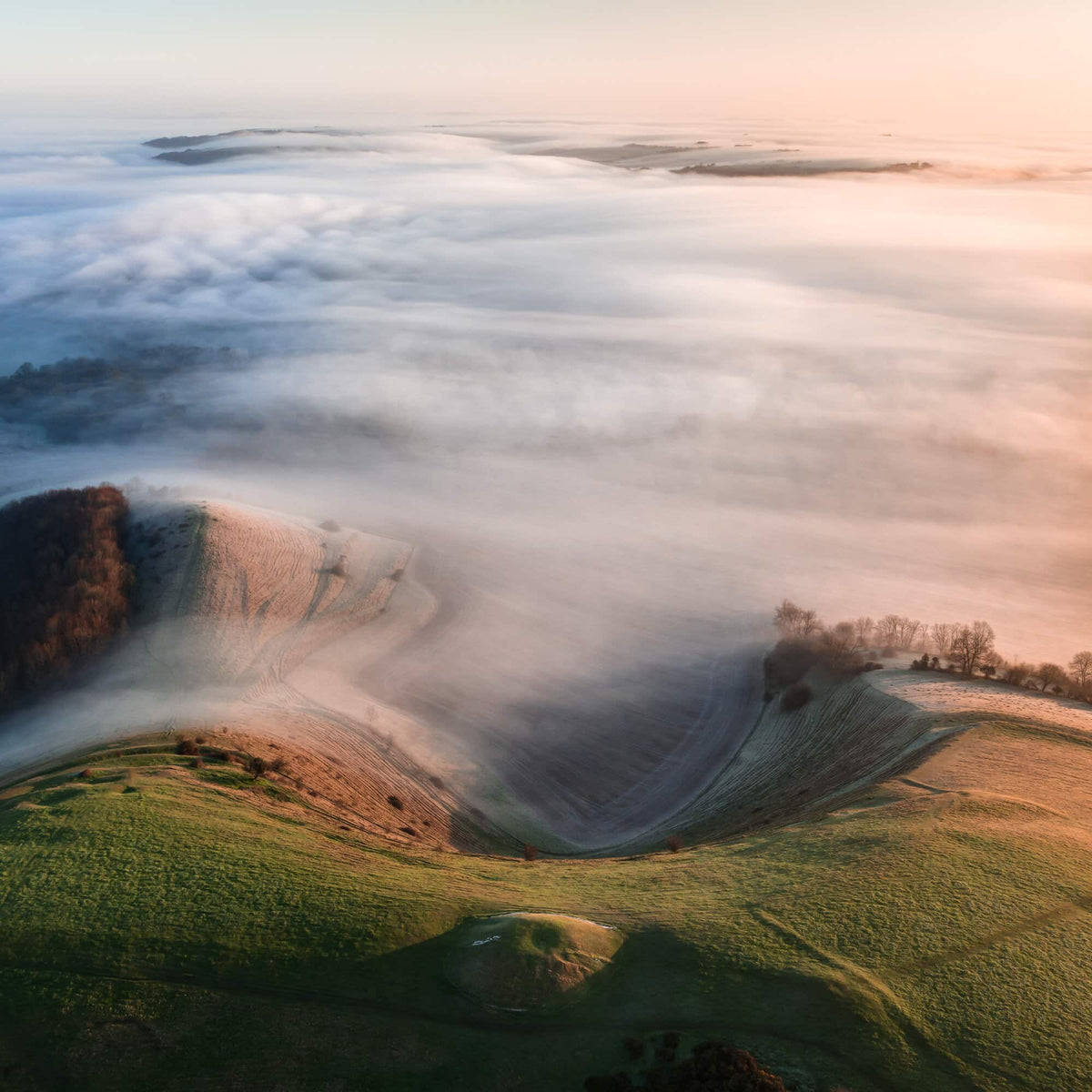
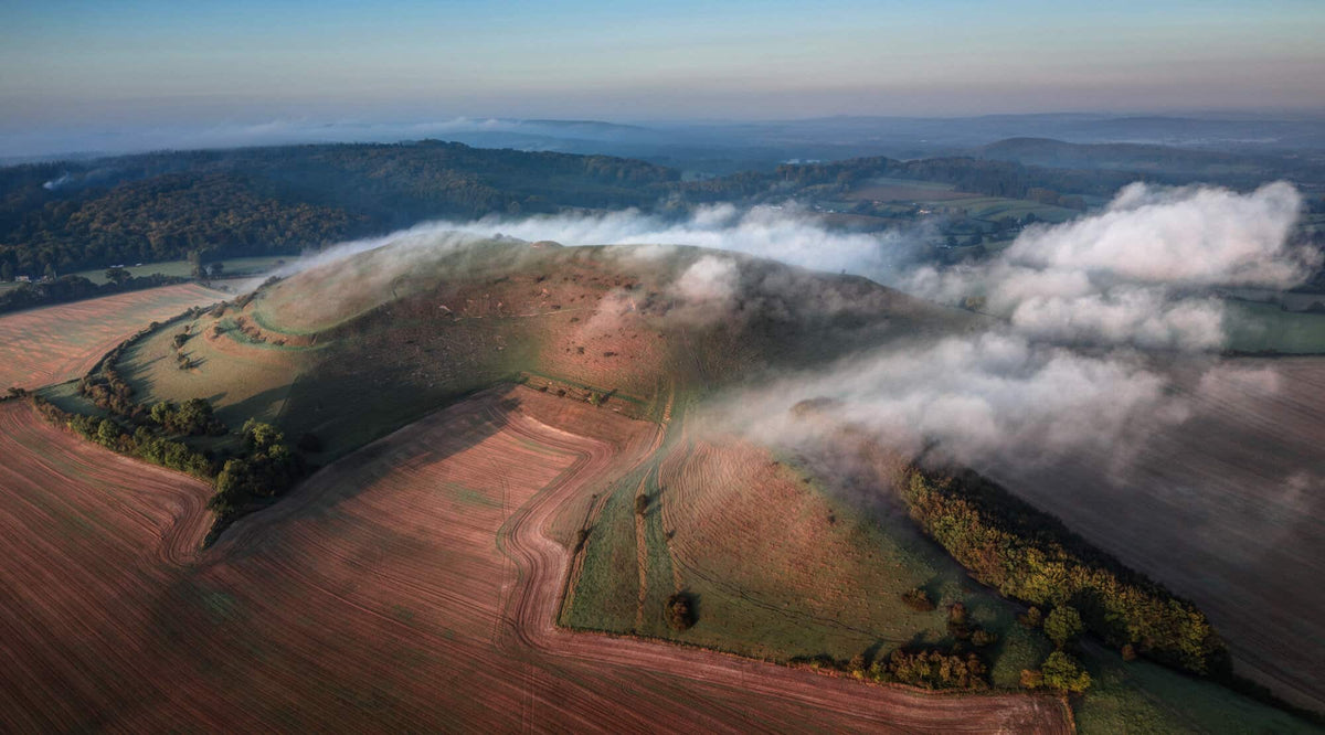
What captures your imagination most about these prehistoric sites?
What captures my imagination is finding some sort of tangible connection with people that lived in these landscapes years before. Once you start to learn about it, you can quickly get a sense of the world they inhabited and how different it was, as well as how similar they were to us. Understanding these monuments and how they relate to the landscape and each other unlocks a new way of engaging with the world around us. For me, it feels like you are communing with human lives from millennia ago.
In its topography and shape, the landscape around us hasn’t changed. The hills are the same. The course of rivers hasn’t altered. But the land has been deforested and damaged or over-layered and it can be very difficult to see beyond that.
So many of these national treasures have been ploughed over in the past 50 years so we only have a fraction left now. Many of them are protected from farming but they are not really understood or appreciated for what they are. My work is about drawing attention to these places.
“It feels like you are communing with human lives from millennia ago.”
- David R Abram
Do you have a favourite memory from photographing a particular site?
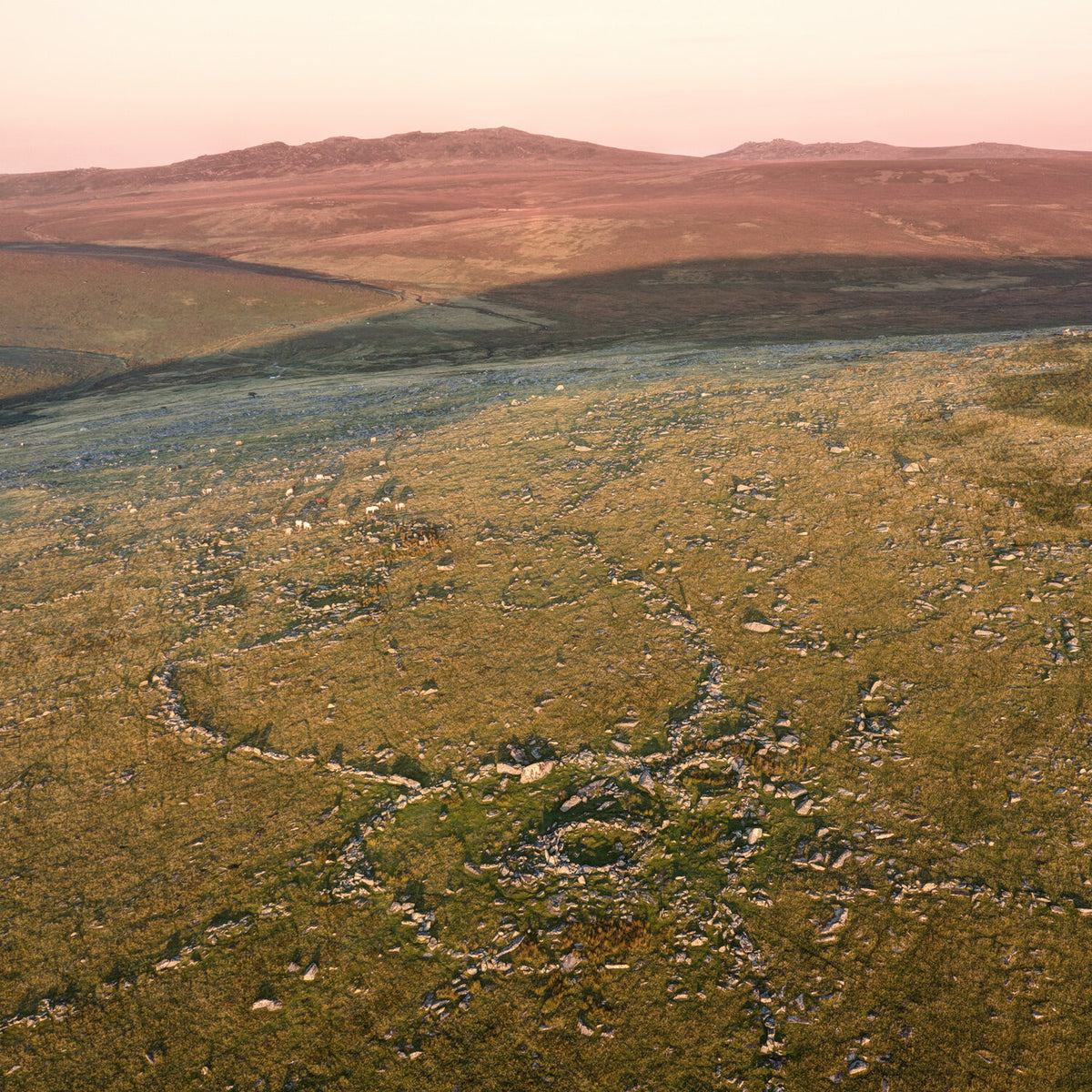
The most amazing thing is when I discover places via other monuments – when our ancestors are pointing to things I didn’t know existed. For example, I was at a place called Leskernick, which is a Bronze Age settlement on Bodmin Moor. I was exploring around the edge of it and I came across this enormous boulder that had been propped up with smaller stones wedged underneath it so that it sat at a particular angle. I realised that a seam in the middle of the stone was pointing directly to a ‘tor’, or natural rock formation, on the horizon. I walked across the valley to it and when I arrived I found this extraordinary sight: a weirdly eroded granite outcrop on a ridge-top, called Showery Tor. It was clear from the thousands of smaller stones laid around its base that this outcrop had been venerated in Neolithic times and that it had been pointed out deliberately as something important. It had this anthropomorphic, godlike feeling to it. I went back the next morning and managed to get some photographs of it, which are now in the book.
To find a place like that simply because I was able to read the language of the stone, the shadows and the light, was very special. The magic is still there – you just have to attune yourself to it.

Why are the solstices and equinoxes such special days for you and your work?
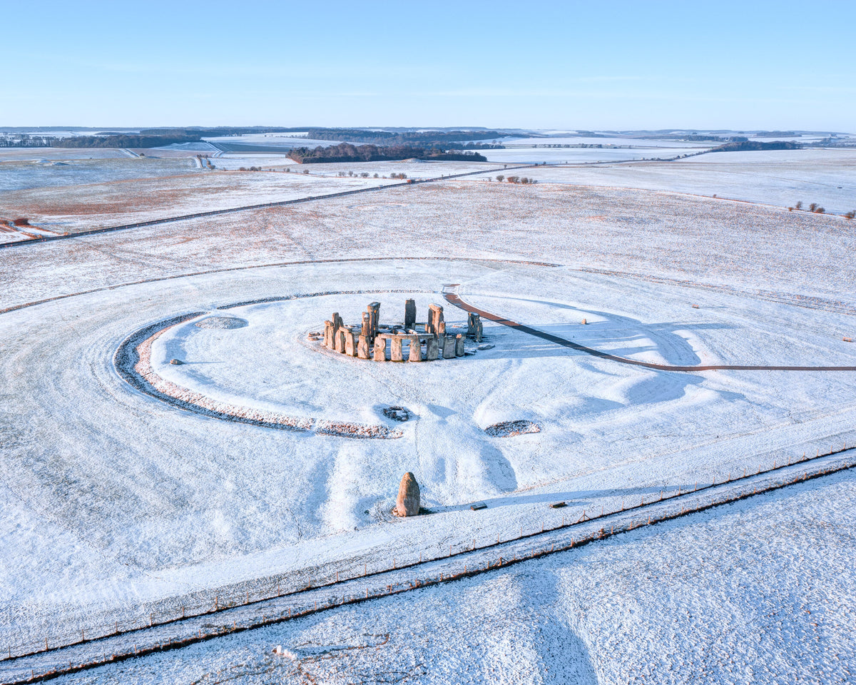
Our Neolithic ancestors were observant and they took careful note of the world around them, including celestial movements. There were all sorts of reasons why they chose these sites (such as proximity to a river) but they would always align them very carefully with particular points on the horizon and the solar cycle. We know that Stonehenge, for example, acted like a calendar. From the points on the horizon they would have known where they were in the year and that knowledge would have been handed down the generations.
Shadows and light play a great role in my work because of how they reveal and exaggerate the shapes and forms of vertical objects. At key moments in the astrological calendar, like solstices and equinoxes, the shadows in images of stone circles can, when viewed directly from above, distort your sense of perspective and reveal new possible meanings.
How did you approach writing and curating your book?
I had built up a body of work from years of photographing these sites and it became obvious to me that they would make a good way of telling the story of prehistory, from the beginning of human settlement in these islands right up to the Romans. Each site could be used as a springboard for talking about different aspects of life in those times.
Every spread covers a different site; it is tempting to dip in and out but ultimately the book was written to be read from start to finish and to tell a story.
How has your work changed you?
I now have a much keener sense of how people inhabited the land around us through various epochs. This work has also unlocked hidden landscapes for me; I’m aware of all kinds of places that might just seem like random sights in the midst of fields but actually once sat at the head of a valley, where a river rose, that then flowed into a bigger river, which flowed into the Thames, for example. It has given me a keen sense of the topography of our country – how it rises and falls.
Now when I’m travelling to Scotland, say, I won't think about what service station I’ll stop at – it’s “which henge shall I stop at?”!
And how do you hope your work changes others?
I hope that it might encourage people to visit these sites and therefore demonstrate their value to landowners, thereby helping to preserve them for future generations.
The unexpected joy of all this has been the response from people. I can see how it affects people emotionally and I'm amazed by it and gratified by that.
What do you wish more people knew about Ancient Britain?
I wish that more people learned about the landscape, where the rivers were, or used to be, and what has been destroyed. That's really important. I’ve learned the extent to which our ancestors valued things that have often long disappeared.

What should be on the agenda for a weekend in Wiltshire/Somerset?
You could go to Avebury, Windmill Hill, West Kennet, Silbury. And then up on Pewsey Down there are some amazing, very early Neolithic sites around the place, such as Knap Hill and Adam’s Grave.
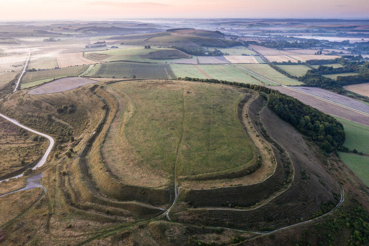
Then you could visit Stonehenge and look at the less well-known monuments surrounding the site, as well as the incredible Iron Age hill forts we have around the Wylye Valley. On the Marlborough Downs there are also enormous hill forts that make a real impact from the ground.
Then, if I was near Stourhead, I’d go up White Sheet Hill – that’s the most important monument in this area. There is a Neolithic enclosure there going right back to the 36th or 37th century BC.
England is actually a very modern idea. Our history is so multi-layered and ‘England’ as we think of it only really started with the Anglo-Saxons. To me, prehistory really gets to the essence of England, which is about the rivers, hills and forests, and how people have come to this island and used the resources at their disposal to shape lives for themselves and their families.


